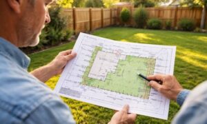

Renovating your home sounds exciting. Maybe you want a bigger bedroom, a larger patio, or a brand-new sunroom. But once your project grows past 400 square feet, things get more complex. At that size, the land under your home matters just as much as the design itself. This is why a topographic survey becomes one of the smartest steps you can take before building anything new.
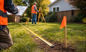
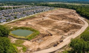
A topographic survey maps the shape and elevation of your land. It shows slopes, high spots, low spots, drainage paths, and how water naturally moves across your yard. This may sound simple, yet Orlando’s terrain makes these details extremely important. With our mix of rainstorms, retention ponds, uneven lots, and a high water table, even a small change in the ground can create big problems.
Orlando’s Land Isn’t as Flat as People Think
Many homeowners assume Florida land is flat. It isn’t. Orlando properties often have gentle slopes you don’t notice until something goes wrong. Water may drain well today, but once you add a large room, patio, or deck, the flow can change fast.
A big renovation adds new surfaces, edges, and roof lines. Even a small shift can push rainwater toward your home or a neighbor’s yard. Orlando gets heavy storms, so these issues show up quickly.
A topographic survey reveals the natural shape of your land before you build. It also helps your designer or engineer spot risks early, so you avoid surprises later.
Why the 400 sq ft Mark Is Important
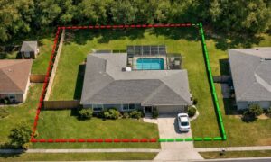
Cities in Central Florida start requiring more documentation when a renovation passes around 400 sq ft. At that size, your project can change how water moves on your property. That is why reviewers often ask for drainage plans or grading plans.
Once your addition reaches this size:
- You add more roof runoff.
- You create more surface area where water can’t soak into the soil.
- You change how the yard drains after storms.
City reviewers must confirm that your renovation won’t cause flooding. Without a topographic survey, there is no accurate way to design the plans they need. And without accurate elevation data, the project may get delayed or denied.
Waiting a few days for a survey is far easier than waiting weeks for permit revisions.
Florida’s High Water Table Makes Elevation Data Critical
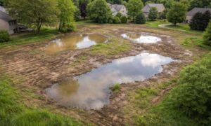
Orlando sits on sandy soil with a high water table. Water is often close to the surface, so even a small low spot in your yard can cause standing water.
A topographic survey helps show how deep you can build without hitting water. It also tells your engineer whether your project needs to fill dirt, grading, or elevation changes. This prevents future settling, cracking, or sinking.
When homeowners skip this step, they often face problems months later—uneven floors, cracked concrete, moisture issues, or sinking patios. Fixing those issues costs far more than doing the survey at the start.
Modern Tools Make Topographic Surveys More Accurate Than Ever

Surveyors today use more than just traditional equipment. Tools like drones and LiDAR help capture land details quickly and with high accuracy. These methods are especially useful, where many backyards have slopes, trees, or uneven areas. With so many factors affecting how water moves across a property, most homeowners benefit from a complete terrain evaluation service that shows the land’s true shape before any major work begins.
Drone surveys can capture thousands of elevation points in a single flight. The results show a 3D model of your yard that engineers can use to design drainage and grading plans. This level of detail is extremely helpful for renovations over 400 sq ft.
Traditional tools like GPS and total stations still work well for smaller lots or tight spaces between houses. Many surveyors use both methods together to get the clearest picture of your land. This hybrid approach gives you accuracy and speed at the same time.
Real Problems That Happen When Homeowners Skip the Survey
You might think, “My yard looks fine. Do I really need a survey?” Many homeowners felt the same way—until their projects ran into trouble. Here are common issues that happen without a topographic survey:
- A room addition blocked a natural low spot, causing rainwater to pool against the new wall.
- A poured patio shifted the slope by only an inch or two, sending stormwater into a neighbor’s yard.
- A permit reviewer noticed the yard was uneven, so the city denied the plans until a proper survey was done.
- A pool builder hit groundwater sooner than expected and had to bring in truckloads of fill dirt.
Each of these problems could have been avoided with a topographic survey. Elevation data doesn’t just help with planning—it saves time, money, and frustration.
The Survey Sets the Entire Project Up for Success
A topographic survey is the foundation of a good renovation plan. Architects, engineers, and contractors all rely on accurate elevations to design the project the right way. Without this information, every step becomes a guess. Guessing leads to mistakes.
The survey supports every part of your renovation:
- The design layout
- The grading plan
- The drainage plan
- The city permit package
When everyone is working with the same accurate information, the project moves smoothly.
When to Order Your Topographic Survey
The best time to order a survey is before your designer starts drafting your plans. This gives them real numbers to work from, which helps them design something that meets both your needs and the city’s requirements.
Most surveys take one day on site and a few days to process. Ordering it early keeps your whole project on schedule.
Build Your Renovation on Solid Ground
Renovations over 400 sq ft change how your property handles water. Orlando’s slopes, storms, and soil conditions make accuracy essential. A topographic survey is a simple step that protects your home, your budget, and your peace of mind.
When you understand the land, every part of your renovation becomes safer and smoother. It’s a small investment that can prevent major problems later.