When the skies opened over Central Florida this week, it wasn’t even a hurricane—but it sure felt like one. Nearly 20 inches of rain fell across Orlando and nearby cities, flooding streets, washing out roads, and even opening up a few sinkholes near Eustis and Mount Dora. While homeowners rushed to drain their driveways and clean up debris, another problem quietly began to surface—property boundaries that no longer line up quite right. If you’re planning repairs or rebuilding after the storm, now’s the time to order a boundary line survey. It’s not just a piece of paper—it’s your proof of where your property truly begins and ends. And after a flood, that clarity can save you from costly mistakes.
When Floods Shift the Ground Beneath You
Heavy rain doesn’t just soak the yard—it moves it. Water can erode topsoil, wash away survey markers, and shift fences ever so slightly. You might not notice it at first, but small shifts can become big issues later.
Across Central Florida, many neighborhoods sit on sandy or limestone soil that drains quickly but also collapses easily when saturated. That’s why sinkholes and settling foundations often follow big storms here. What looks like a simple fence repair could turn into a boundary dispute if your property line has changed by even a few inches.
After this latest storm, it’s smart to assume the ground has moved just enough to deserve a second look.
What a Boundary Line Survey Really Does
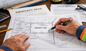
A boundary line survey defines the exact edges of your property based on legal records and physical evidence on the ground. A licensed land surveyor reviews your deed, subdivision plat, and previous surveys, then measures the land to confirm where your lot truly ends.
But after extreme weather, it’s not just about finding old markers. Surveyors also check if floodwaters or erosion changed your lot’s contours or exposed buried corners. They’ll set new reference points if necessary and make sure your boundaries align with your title documents.
Think of it like a reality check for your property lines—one that keeps your next renovation grounded in facts, not guesses.
Why This Matters Before You Renovate
Imagine rebuilding your fence or patio only to find out later that part of it crosses onto your neighbor’s property. It happens more often than you’d think—especially after storms that move soil or tilt fences.
A current survey prevents these headaches. It gives your contractor a reliable map to work from and helps avoid permit delays with the city. In some cases, it can even help with insurance or FEMA claims. If water damage pushes soil across your property line, survey data helps prove the extent of the shift when you talk to your insurer or adjuster.
And let’s be honest—after the stress of cleanup, no one wants another surprise bill or boundary argument.
Orlando’s Unique Risk
Central Florida’s charm comes with a challenge: our soil and water table are constantly changing. Orlando, Apopka, and nearby Lake County areas sit on porous limestone, which means heavy rain seeps underground and sometimes creates empty pockets that collapse later.
Add in the fact that most homes share fences, drainage swales, or retaining walls—and you’ve got a recipe for confusion. After this recent “non-hurricane” flood, many property markers are likely gone or buried. That’s why surveyors are getting more calls right now than during hurricane season.
If you’re already scheduling contractors for driveway or foundation repairs, this is the perfect time to book a survey too. It keeps everyone working from the same, accurate plan.
What Happens During the Survey

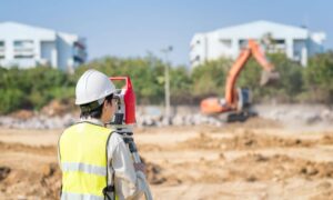
A local licensed land surveyor will visit your property with precise instruments—often GPS units and total stations—to measure your boundaries. They’ll look for old iron pins, monuments, and physical clues, then confirm those against official land records.
If anything’s missing or disturbed, they’ll reset the markers and provide you with an updated drawing. Some surveyors also add topographic or elevation data if you request it, especially helpful if your property slopes or has flood concerns.
You’ll end up with a clear report showing your true property lines. This document becomes your best reference for permits, insurance, or construction planning.
Real Story, Real Impact
After Hurricane Ian in 2022, a homeowner near Lake Apopka replaced a wooden fence that the wind had knocked down. Months later, his neighbor claimed the new fence sat two feet inside his lot. When they checked the county’s property appraiser map, the lines didn’t match. A boundary line survey finally revealed that floodwater had shifted the old markers. The fence had to be moved again—costing thousands in labor and materials.
That’s why acting early matters. Storm damage is already expensive. Don’t let unclear property lines make it worse.
Small Step, Big Protection
Getting a survey might sound like an extra task during a stressful cleanup, but it’s one of the simplest ways to protect your investment. A new boundary line survey costs far less than fixing a property dispute or redoing misplaced work.
Plus, it sets you up for smoother permitting. Orlando’s building department often requires proof of accurate lot lines for new fences, additions, or driveways. Submitting a recent survey can speed up approvals and reassure inspectors that your project meets local setback rules.
Choosing the Right Surveyor
Look for a licensed boundary surveyor who understands local soil and drainage patterns. Ask if they’ve done post-storm surveys before. Experienced surveyors know what signs of erosion or ground movement to watch for and can provide both a boundary and elevation update if needed.
Don’t rely on old surveys from when you bought the home—especially if they’re over five years old. The land changes more often than people think, and you want your records to reflect today’s reality, not last decade’s.
Final Thoughts
This week’s flood reminded everyone that storms don’t have to be hurricanes to cause major shifts. Roads collapsed, sinkholes appeared, and foundations cracked—all without a named storm. For homeowners, that means it’s time to double-check more than your roof or gutters.
Before you pour new concrete, rebuild a fence, or start landscaping, make sure your property lines are where you think they are. A quick boundary line survey gives you peace of mind, protects you from legal disputes, and ensures every repair or renovation you make stays on solid—and truly yours—ground.


