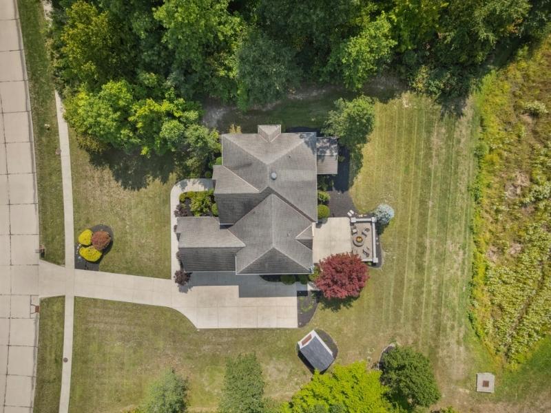
Two lots can list the same acreage and still allow very different projects. One may fit a new home, a pool, and a detached garage. The other may lose a third of its space to a drainage easement, a slope, and a front setback.
A land surveyor helps you see which kind of lot you have before you spend money on design. The survey measures what you own, what limits apply, and how the ground behaves. With those facts, you can choose the best use of the land instead of guessing at it.
Looking Beyond Lot Size to Understand Buildable Space
Lot size tells you how much land you own. Buildable space tells you how much of it you can actually build on. The gap between those two numbers often surprises buyers.
Buildable space is the part of a lot left over after rules and site limits are taken out. A land surveyor maps the lines first, then shows the features and recorded limits that cut into that area. Common ones include:
- Front, side, and rear setbacks
- Recorded easements for utilities, drainage, or access
- Steep slopes or low, wet areas
- Existing structures, trees, or driveways you plan to keep
Once these are drawn, the usable part of the lot gets much clearer. A half-acre lot might only have a modest building area in the middle. Knowing that early keeps your plans grounded in what the site can hold.
How a Land Surveyor Identifies Opportunities for Property Improvements
A land surveyor’s map can also show space you didn’t know you had. Many owners assume their back fence marks the rear line, but the true line may sit several feet behind it. That extra room can change what fits on the lot.
Surveys often help owners spot room for:
- A pool, shed, or detached garage
- A home addition or covered patio
- A second driveway or wider parking pad
- A guest house, if local rules allow it
Each idea still needs to pass zoning and permit review. Rules can vary by city, county, HOA, and project type. Your surveyor can give you the measurements, and your local planning office can confirm what’s allowed.
Evaluating Terrain, Drainage Patterns, and Natural Site Features
The shape of the ground matters as much as the shape of the lot. A topographic survey measures high and low points and shows them as contour lines on a map. Contour lines connect spots of the same height, so you can see where the ground rises or falls.
This matters because water always moves downhill. If you build in a low spot, rain may pool against your foundation or under a new slab. A land surveyor can show where water is likely to flow, so your designer or engineer can plan grading and drainage around it.
Natural features also shape good use. Large trees, ponds, wetlands, and soft soils can limit where you build. Some of these may have their own rules, so ask your surveyor to locate them and check with the county about any protections.
Flood zones deserve a close look too. A survey can show your ground elevation, which helps your builder plan floor heights. Lenders and insurers may ask for an elevation certificate, depending on the flood zone and the project.
Where Setbacks and Easements Influence Residential Development Plans
Setbacks and easements are two of the biggest limits on residential land. A setback is the minimum distance a building must stay from a property line. An easement is a right someone else holds to use part of your land, such as a utility company running a line.
Both can quietly shrink your plans. A pool may not fit if a rear drainage easement runs along the back of the lot. A garage may need to shift if the side setback is wider than you expected.
A land surveyor shows easements that appear in the recorded documents provided for the survey, often from a title report. Setback rules usually come from zoning codes, plats, or HOA covenants. Before you design, confirm:
- Which setbacks apply to your zoning and lot type
- Which easements are recorded against the lot
- Whether any fence, shed, or slab already sits inside an easement
- Who must approve work near an easement
Comparing Potential Uses Through Accurate Property Measurements
Good choices come from good numbers. When you’re weighing two or three plans, accurate measurements let you compare them on equal footing. Guesses from online maps or old fence lines can be off by several feet.
Say you’re choosing between a pool and a larger addition. Your land surveyor’s map shows how much space each needs and what’s left for yard, parking, and drainage. Your designer can then sketch both options on the same drawing and see which works better.
Ask for a survey drawing in a digital format your designer can use. Many surveyors provide CAD files on request. That saves time and helps avoid errors when plans move from paper to the job site.
Timing matters as well. If a closing, permit, or build date depends on the survey, order it early. Fieldwork and drafting can take longer than people expect, especially in busy building seasons.
Frequently Asked Questions
What does a land surveyor do for residential property?
A land surveyor measures and maps your property lines, corners, and key features. They can also show buildings, fences, easements, and ground heights. This gives you a clear picture of what you own and what limits apply. Many owners use it before buying, building, or adding on.
Can a land surveyor tell me what I’m allowed to build?
A surveyor gives you the measurements and site facts your plans depend on. Zoning and building rules come from your city, county, or HOA. Those offices decide what’s allowed. Bring your survey to them so their review is based on accurate numbers.
What type of survey do I need to plan improvements?
Many owners start with a boundary survey to confirm their lines. If slope or drainage matters, a topographic survey adds ground heights. Some projects need both in one drawing. Tell your surveyor what you plan to build so they can suggest the right scope.